
Civil 3D features
With tools designed for critical civil engineering disciplines, see how Civil 3D can help you create better infrastructure.
Civil infrastructure design
Supports faster and efficient design workflows for site design, terrain modelling, corridor modelling and drainage design.
Plan production and documentation
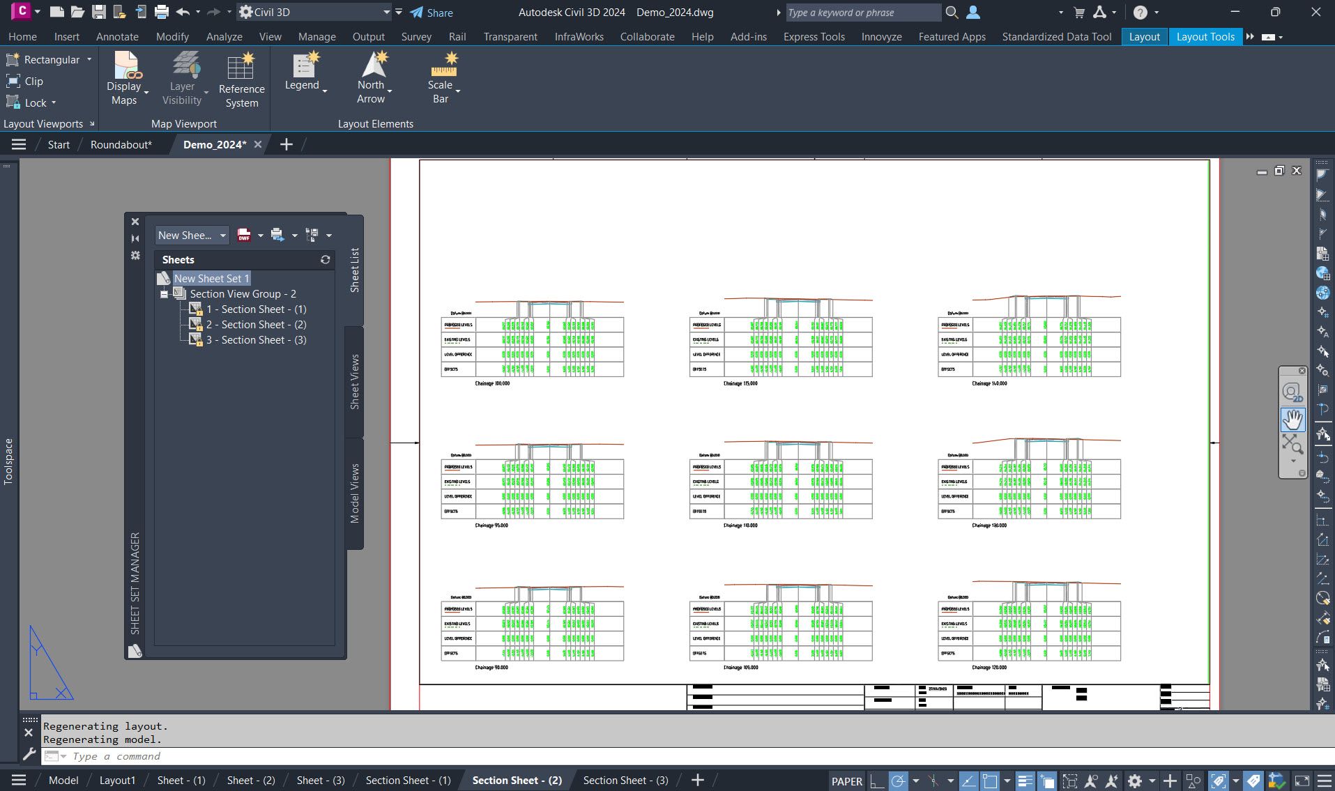
Rapidly generate construction documentation such as plan/profile, plan(s)-only, profile(s)-only, and section sheets from drawings quickly and efficiently.

Interoperability
Civil 3D seamlessly integrates with a range of CAD formats, including IFC, and connects to Esri ArcGIS and Bentley data for effortless import, export, and linking.
Additional features
Surface modelling tools - Generate complex surfaces using a combination of points, breaklines, boundaries, and contours with Civil 3D's advanced surface creation tools. The software supports TIN, grid, cropped, and corridor surfaces.
Point cloud tools - Capture existing conditions and structures using diverse laser scanning and other data acquisition technologies. Import the acquired point data into Civil 3D to create a 3D digital representation for use in your design projects.
Surface editing - Easily edit surfaces with intuitive editing tools that apply changes as edit operations, preserving the integrity of your surface data components.
Surface masks - Use a powerful display tool that allows you to selectively hide areas of a surface or choose a specific render material for display.
Surface watersheds - Analysis capabilities enable you to study water flow on and off surfaces for improved drain target and watershed determination.
Surface volumes - Calculate and analyse volumes of surfaces and their bounded areas with the volumes dashboard.
Surface analysis - Perform comprehensive surface analysis with Civil 3D, including contour analysis, direction analysis, elevation analysis, slope analysis, slope-arrow analysis, watershed analysis and water drop path analysis.
Site design tools - Easily manage site objects such as parcels, alignments, gradings and feature lines with integrated site collection and common topology management.
Survey tools - Streamline your survey data process by quickly downloading, creating, analysing and adjusting field-captured data.
Field-to-finish workflow - Optimise your field-captured survey data processing to create a smart base map.
Geotechnical modelling - Visualise and analyse geotechnical information with Civil 3D and utilise that data in your design models.
Grading tools - Streamline the design of finished ground surfaces with Civil 3D's grading tools and commands.
Grading Optimisation - Use project criteria to easily automate grading design studies for land areas.
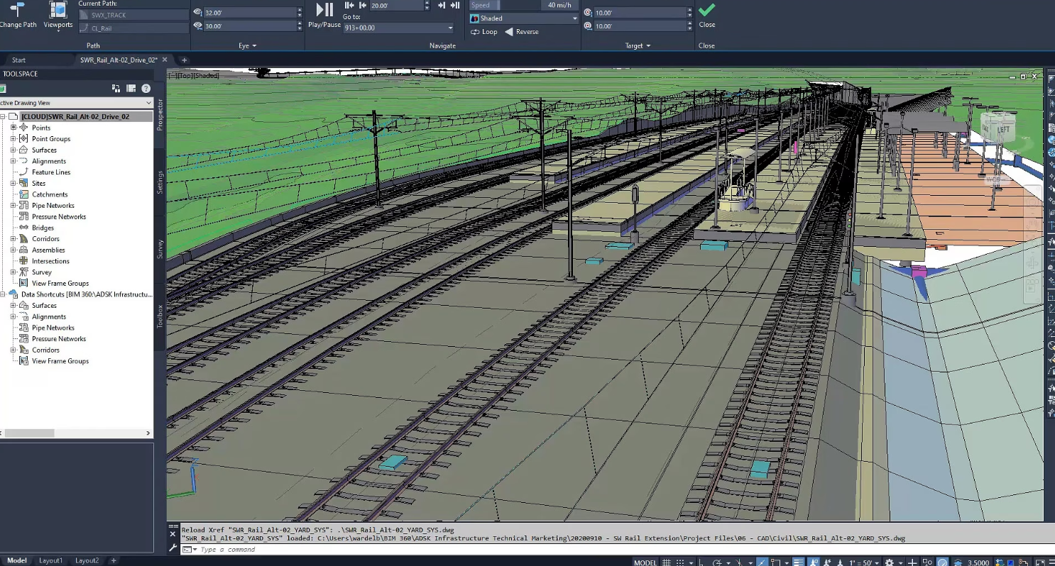
Corridor design tools - Generate dynamic and informative corridor models for roads and highways in Civil 3D. Include designs for turnouts, switches, and cant calculations when creating rail track corridors.
Export corridor data - Easily extract feature lines from corridor models for use in grading design and other projects. Choose to extract all lines at once, select individual lines, or select a subset within a specific region or polygon.
Assemblies and subassemblies - Optimise the creation of roadways and alignment-based designs with the use of efficient assembly and subassembly building blocks.
Intersections and roundabouts - Efficiently design dynamic intersections, including 3-way, 4-way, or roundabouts.
Advanced roundabout design - Streamline the design of roundabouts with precise modelling according to established standards. Easily integrate your roundabout design into corridor models, ensuring automatic updates with changes to corridor alignments.
Modelling pipe networks - Easily create 2D and 3D models of utility systems, including storm sewers and sanitary sewers.
Hydraulics and hydrology tools - Carry out comprehensive stormwater management tasks with ease, including the design of storm sewers, watershed analysis, modelling of detention ponds and analysis of culverts, channels, and inlets.
Pressure network design - Use advanced modelling tools to create 3D representations of pressure networks, including water transmission systems.
Plan production and construction documentation - Easily generate construction documents by combining multiple plan or profile views into one sheet.
QTO and earthwork calculations - Easily generate reports on material volumes and quantities based on sectional or profile information. Accurately analyse material quantities with the help of advanced extraction features.
Dynamo for Civil 3D - Optimise design processes and save time by utilising the Dynamo visual scripting platform to create automated routines for repetitive tasks.
Project Explorer for Civil 3D - Optimise your design process and streamline your work by managing the vast amounts of data in Civil 3D models. This one-stop hub allows you to efficiently review, validate, report, export and edit your design models, ensuring better understanding of your design and seamless distribution of geometric information to stakeholders.
Corridor data shortcut (DREF) - Produce and share data shortcuts for corridors.
3ds Max interoperability - Generate professional-quality visualisations.
IFC import and export - Import and export AutoCAD solids to IFC files.
Exchange data with InfraWorks - Enhance your design process with context modelling and conceptual design. Make informed decisions with a comprehensive view of existing conditions, explore alternatives and streamline detailed design and documentation.